Island Copper Mine: Vegetation Assessment
Northern Vancouver Island · 2017 reclamation assessment
Reclaimed Mine Areas
Vegetation developed differently across the mine, reflecting local ground conditions, planting history and competition.
Pioneering Alder
Red alder provided woody cover and shade as part of the mine’s historical revegetation program.
PES Assessment
PES compared July 2017 observations with earlier monitoring to assess vegetation development and constraints on recovery.
Assessing Vegetation Recovery
Seeded grasses and legumes competed with planted red alder across parts of Island Copper Mine. Recovery varied between reclaimed areas, making follow-up assessment important for understanding where vegetation was developing and where it needed attention.
Polster Environmental Services prepared the 2017 reclamation assessment, using field observations collected July 4–6, 2017 and previous vegetation monitoring.
The assessment examined plant establishment, competition and understory development. The historical photographs below illustrate how these processes unfolded in different parts of the mine.
Red alder contributes to vegetation development in several ways:
Nitrogen fixation can help alder establish on nutrient-poor mine material.
An established canopy shades the grasses and legumes below.
Swordfern, salmonberry and conifer seedlings can establish beneath the canopy.
As a native pioneer tree, alder is part of the region’s natural sequence of forest recovery.
Planting History and Assessment
The historical planting program used red alder to establish woody cover. As the trees grew together, their canopy could reduce the light available to competing grasses and create conditions for understory plants.
The 2017 PES assessment records 505,630 red alder planted mine-wide since 1978. This is the total for the historical planting program across mine areas and years.
PES examined vegetation development along monitored transects. The assessment considered:
- The establishment and growth of planted woody vegetation.
- Competition from seeded grasses and legumes.
- The development of understory vegetation as canopy cover changed.
Red Island: Growth Over Time
The original presentation follows an area at Red Island planted in 1996, with photographs from 1998, 2000 and 2009:
- Planted 1996 / Photographed 1998: Young alder growing among grasses and legumes.
- Photographed 2000: Further alder growth.
- Photographed 2009: Closed or near-closed alder canopy, thirteen years after planting.
The Red Island photographs illustrate the importance of tree establishment and canopy development. Where alder remained scattered, grasses and legumes continued to compete; where trees formed a canopy, shade changed conditions beneath them.
The 2017 assessment found differing responses across monitored areas. Restoration decisions therefore need to account for local surface conditions, competing vegetation and the intended plant community.
Planning reclamation or reviewing an established site? Talk to PES about vegetation assessment. Request a Site Assessment →
Reading the Vegetation
The photographs below illustrate features that help explain how a reclaimed site is developing: ground cover, tree spacing, canopy cover and the plants beneath it.
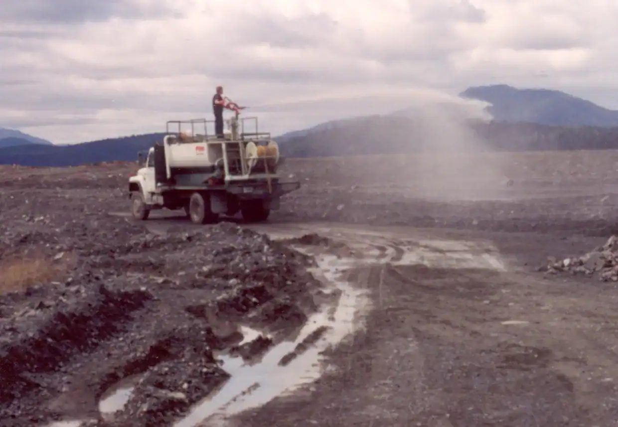
Seeded grass and legume cover on disturbed mine ground.
Dense grass and legume cover can obscure a lack of woody establishment. Looking at the species present helps distinguish ground cover from the development of the intended plant community.
Red alder was used as a pioneering tree on mine soils. Its growth and distribution are useful indicators of how planting has responded to site conditions.
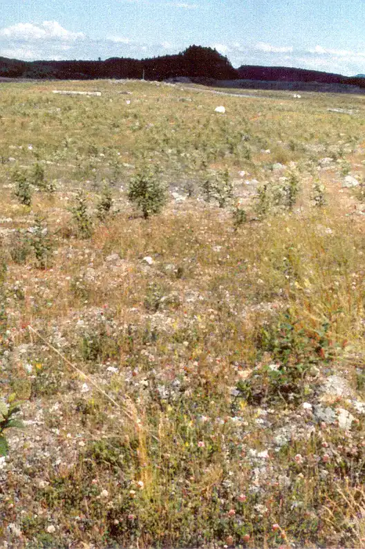
Red Island: planted 1996, photographed 1998.
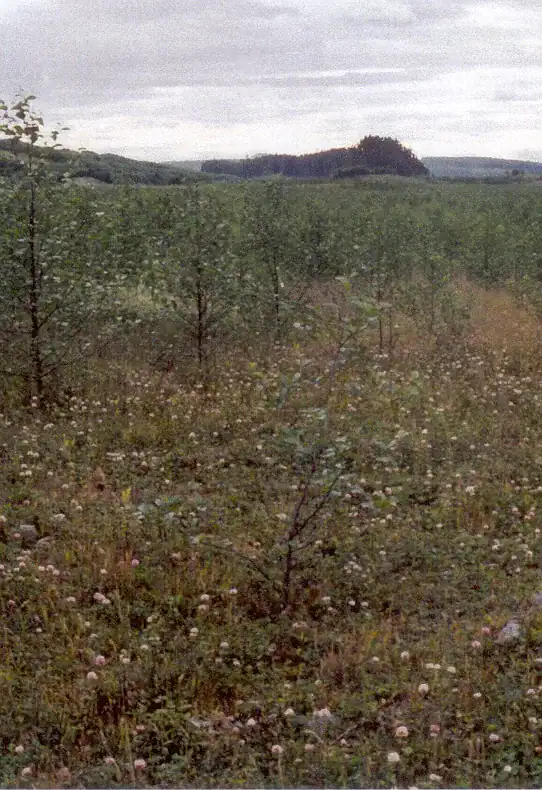
Red Island: photographed 2000.
Tree spacing matters alongside tree height. Gaps between alder stems allow more light to reach the seeded understory, which can continue to compete with young trees.
Open grass-dominated areas need closer assessment of woody plant growth and competition. A green surface alone does not show whether forest vegetation is developing.
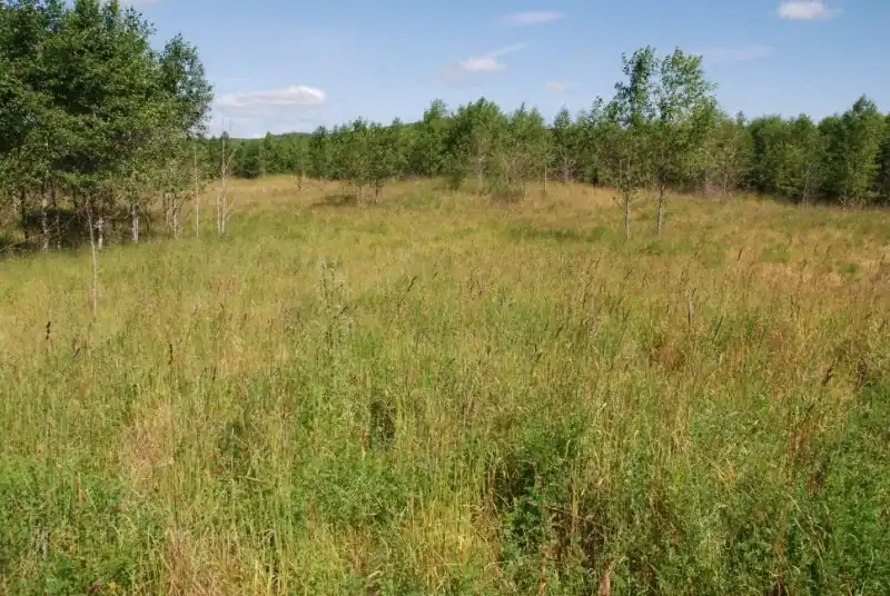
Open ground dominated by seeded cover.
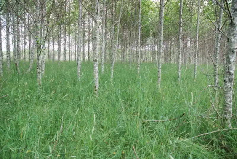
Alder begins to create shade over the seeded layer.
As alder grows, its shade changes conditions for plants beneath it. The density of the canopy and the vegetation remaining below it help indicate this change.
Leaf litter adds organic material beneath the trees. Together with shade, this contributes to conditions in which forest understory plants may establish.
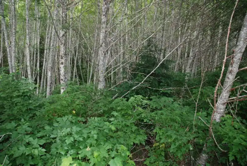
Alder canopy shading the ground below.
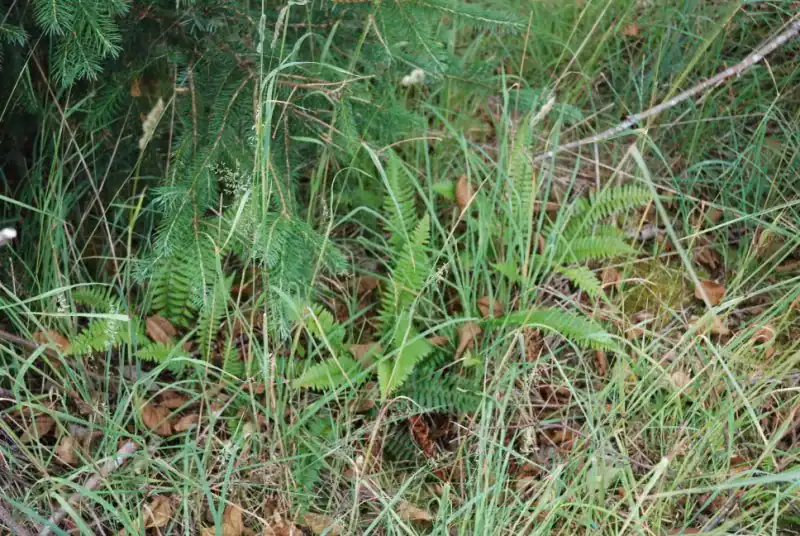
Swordfern beneath the alder canopy.
Swordfern is one of the understory species discussed in David Polster’s presentation. The presentation explains how windborne spores can collect on alder branches and wash to the ground in winter rain.
Conifer seedlings beneath the pioneer trees show another stage of vegetation development. Monitoring their establishment helps assess the transition toward a more varied forest community.
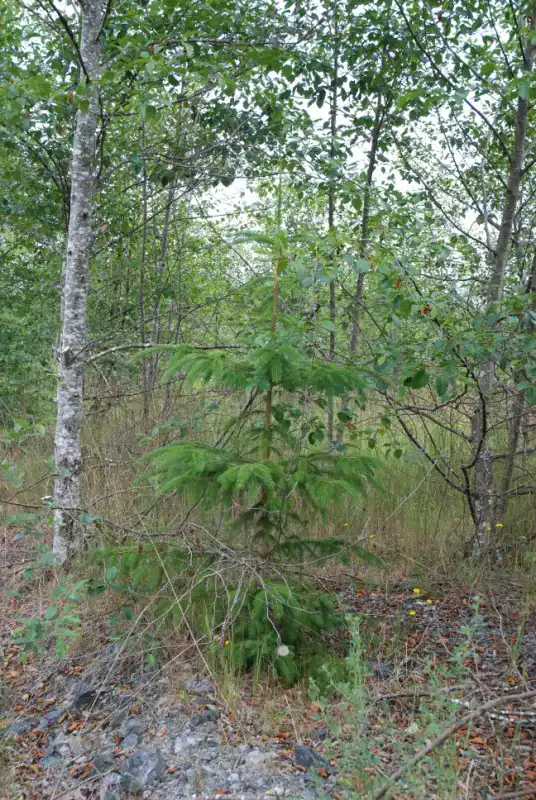
Conifers establish under the alder shelter.
References
- Source deck: David Polster, Seeding Grasses & Legumes, Island Copper Mine.
- Polster, D.F., B. Welchman and C. Hanks. 2001. Revegetation Strategy at the Island Copper Mine.
- Why Grass Seeding Fails
Learn more
Related Methods and Resources
Reviewing Vegetation on a Reclaimed Site?
PES assesses plant establishment, competing vegetation and ground conditions to help owners and project teams plan their next restoration steps.
Island Copper: shoreline and pit context
These two David Polster field photographs document the Island Copper shoreline and pit-water setting in July 2008, adding landscape context to the reclamation strategy and later vegetation record.
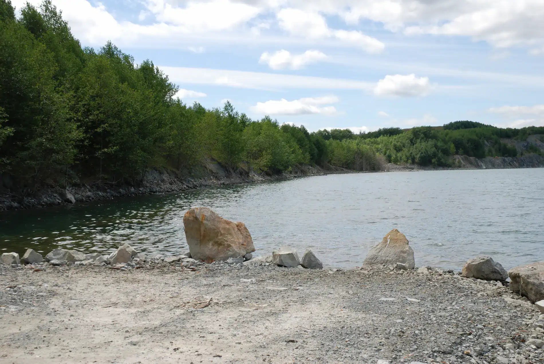
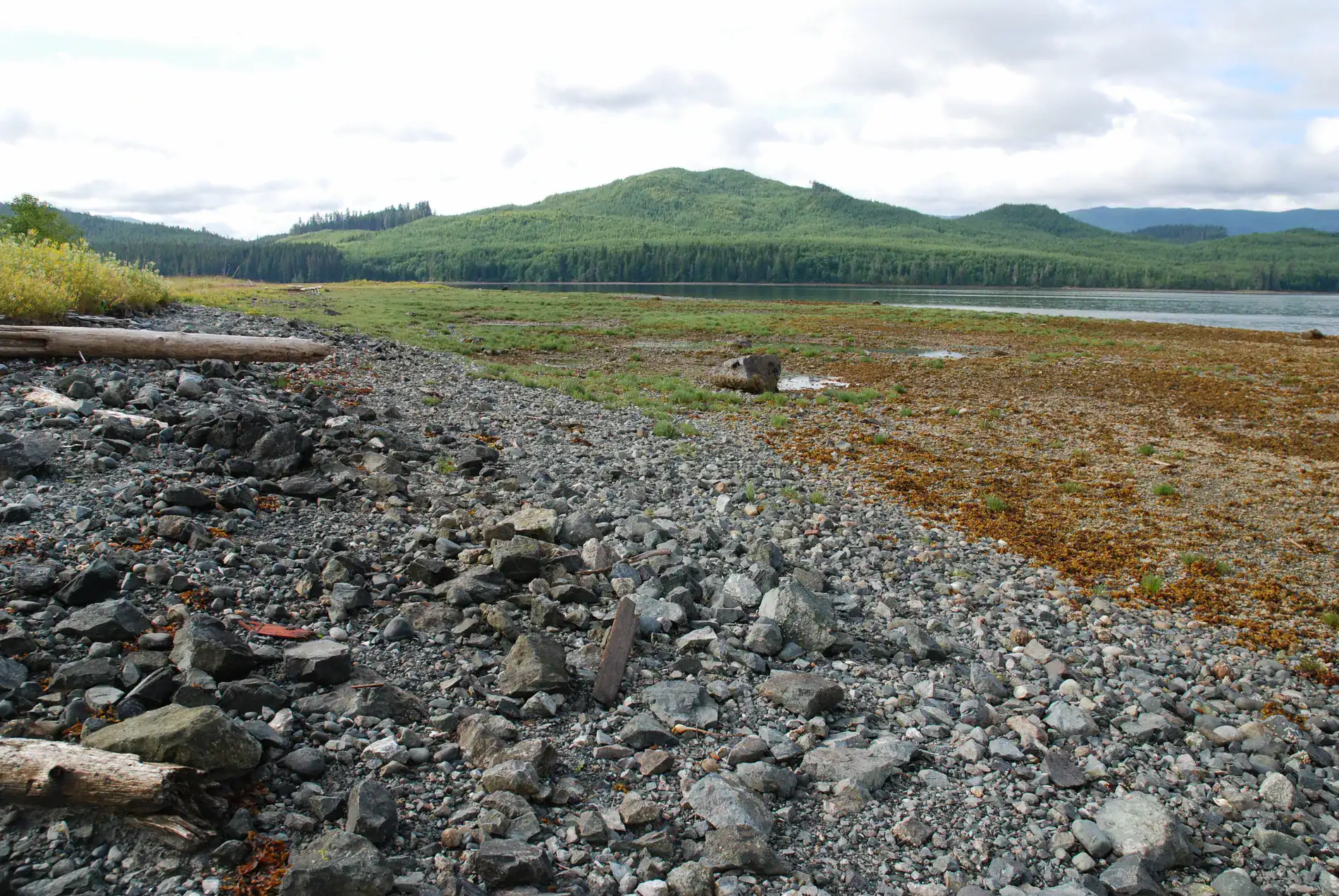
The views are dated context photographs from different positions, not a fixed-camera treatment comparison. The existing Island Copper record remains the source for reclamation strategy and later-condition discussion.
Island Copper Plantsite, 2002–2005
David Polster’s photographs show vegetation developing at the reclaimed plantsite between 2002 and 2005. This is a separate area from the Red Island sequence above.
The first archive frame shows the plantsite with open ground and limited cover.
Source: David Polster's Island Copper archive photographs, dated 2002, 2004, and July 26, 2005. Viewpoints vary between photographs.