Saltwater shoreline restoration | 2008 to 2019
Bamberton Shoreline Restoration
A natural-model shoreline repair using cobble, large wood, beach vegetation, and live planting, with later monitoring through winter storms and a localized boat-ramp constraint.
Project overview
The Bamberton shoreline was restored using a nearby reference ecosystem rather than a uniform hard-armour template. The reference shore combined cobbles, large wood, and beach rye, elements that occur together on natural British Columbia saltwater shorelines.
The photographs below are dated site records from 2008 through 2019. They show different viewpoints and should be read as project progression, not a fixed-camera before-and-after comparison.
Reference ecosystem and shoreline challenge
The treatment needed to protect an eroding, publicly used shoreline while retaining a natural shore form. The reference ecosystem showed how cobble, logs, and rooted beach vegetation can work together as a flexible system.
Work on March 25 and 26, 2008 placed and planted the natural materials. The design depended on the relationship between shoreline form, wood, stone, and vegetation rather than any one component in isolation.
Installation and storm response
By May 2008, vegetation was establishing and the treated shoreline remained stable. November 2008 and January 2009 inspections documented the site through winter storm conditions, high water, and waves.
Later photographs show willow and shoreline vegetation continuing to strengthen the treated area. These observations are specific to the monitored conditions and do not remove the need for site-specific coastal design.
Bamberton: shoreline installation to established cover
Move through the dated shoreline record from the March 2008 installation to established vegetation, including the localized boat-ramp limitation documented in 2012.
These images document the same project over time, but viewpoints vary. This is a dated field progression, not a registered fixed-camera before-and-after comparison.
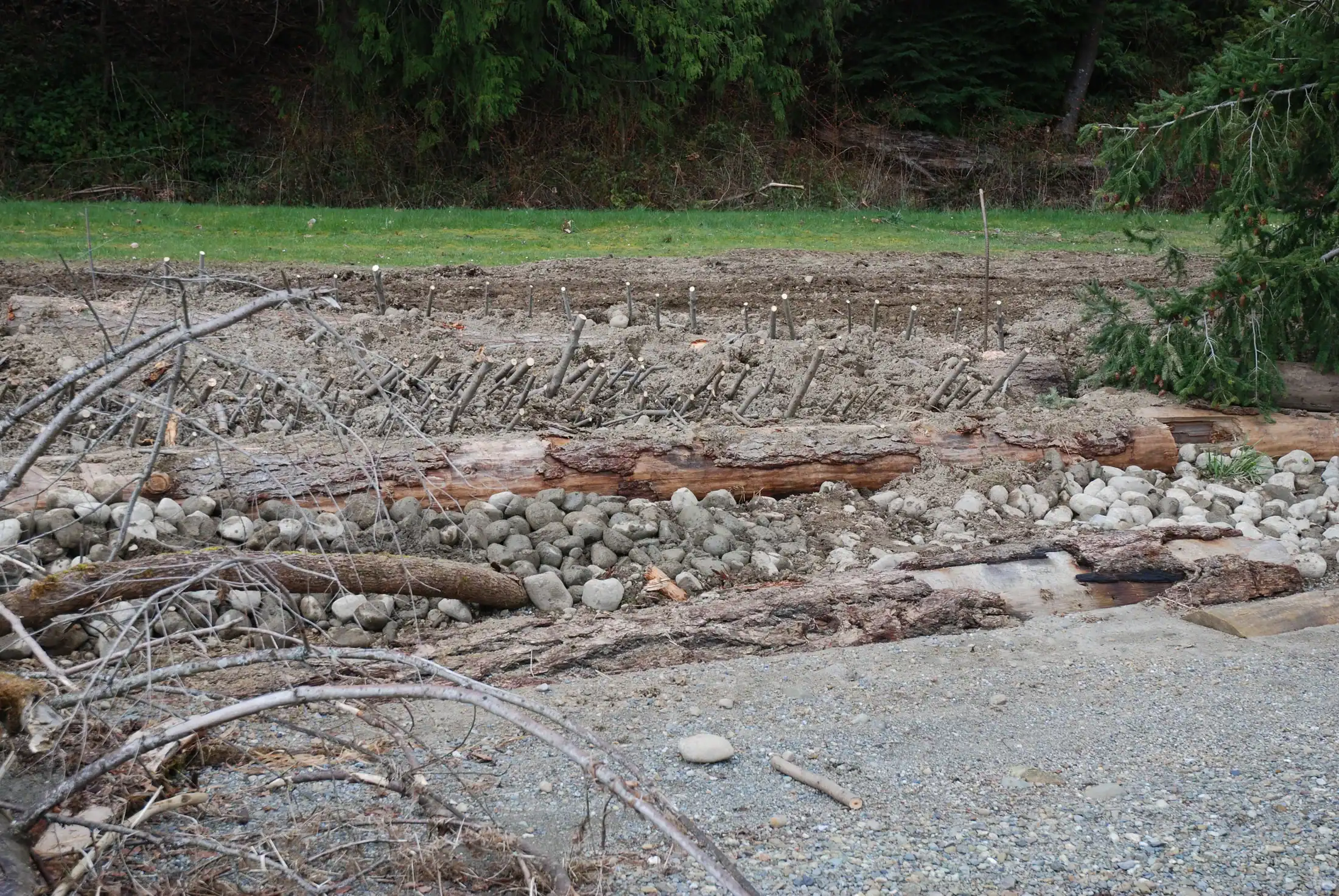
March 2008. Cobble, logs, beach rye, and native planting were arranged to follow a natural shoreline model.
Full dated photo record
These photographs use verified project originals and dated archive folders. Viewpoints vary across the sequence.
2008-03-26. Cobble, logs, beach rye, and native planting were arranged to follow a natural shoreline model.
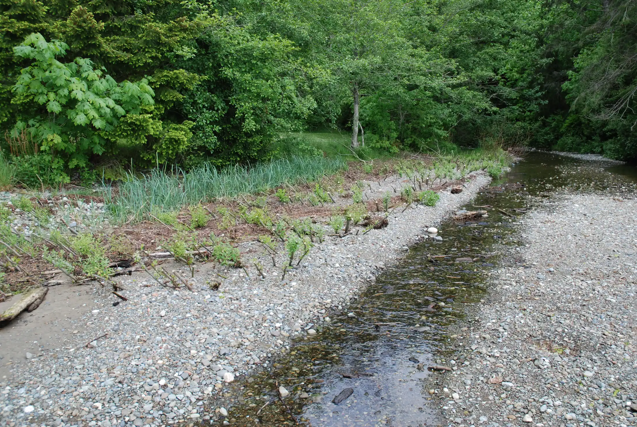
2008-05-22. Live cuttings and beach vegetation were establishing along the rebuilt shoreline.

2008-11-05. The natural shoreline form remained in place through the first winter storm season.

2009-01-07. Cobble, wood, and vegetation remained integrated after high water and wave action.
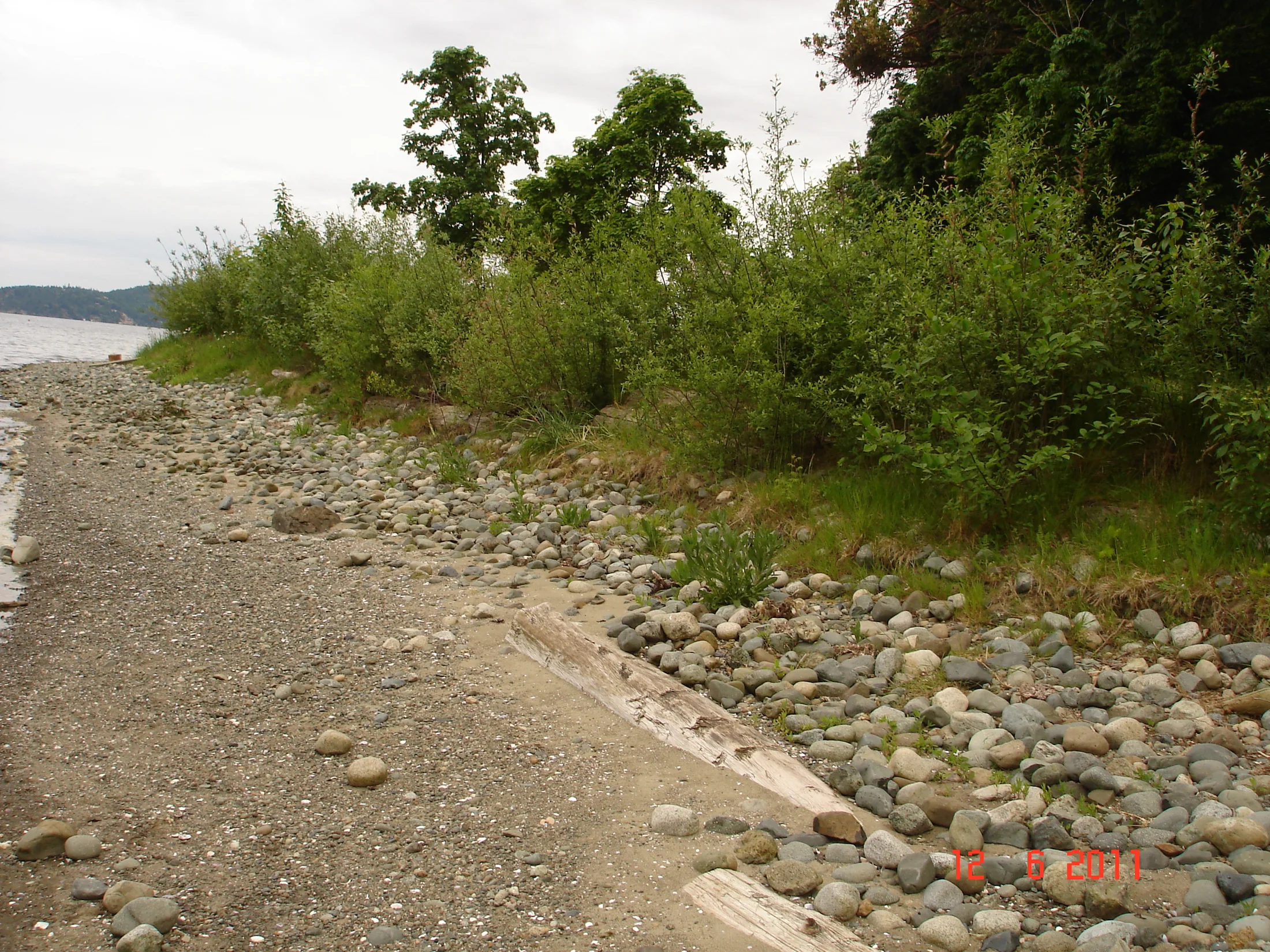
2011-06-12. Rooted vegetation was strengthening the shoreline and increasing habitat structure.
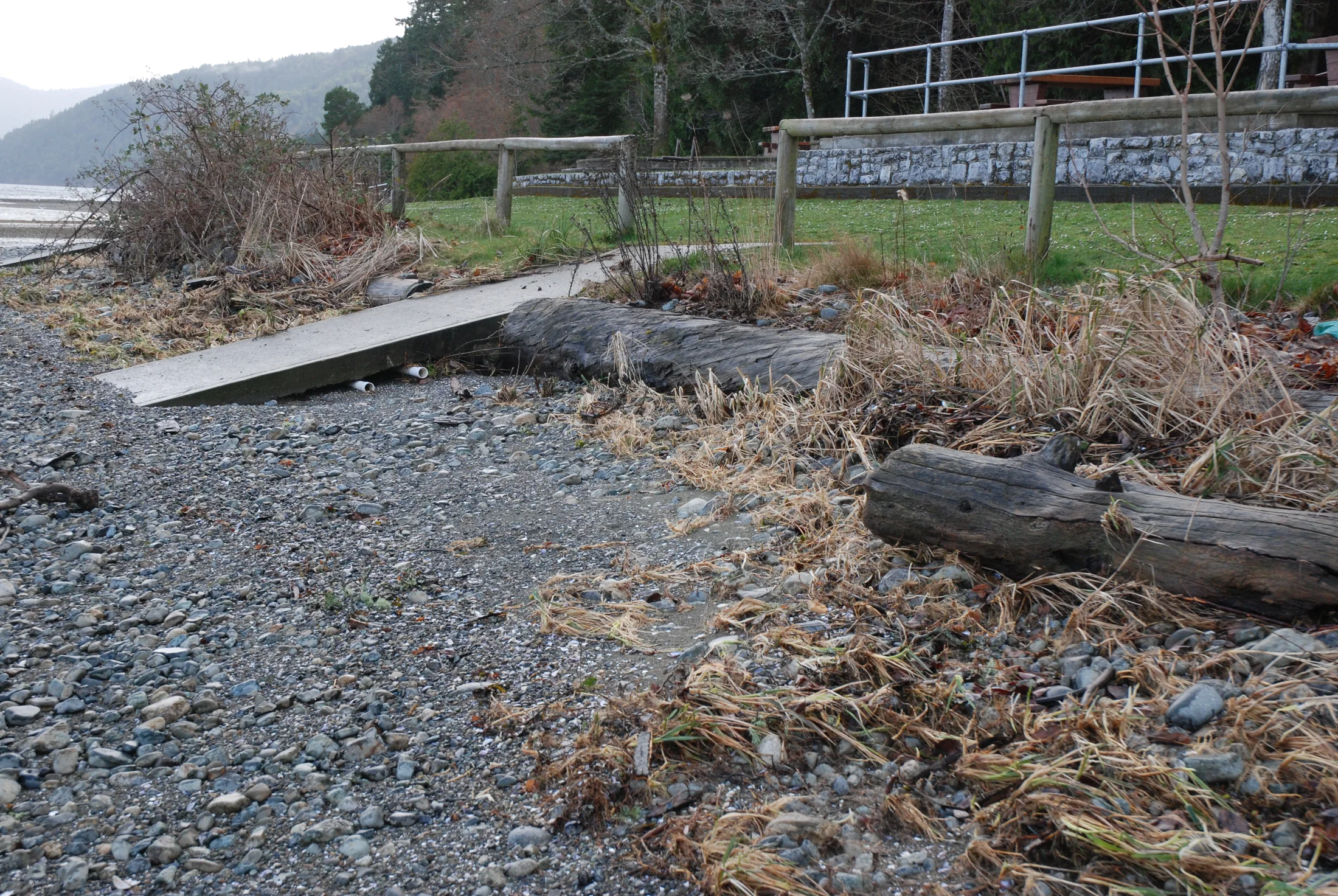
2012-03-15. Localized erosion beside the concrete boat ramp showed how hard interruptions can concentrate wave energy.

2019-01-27. Vegetation, cobble, and large wood continued to function as an integrated shoreline system.
A useful limitation at the boat ramp
The concrete boat ramp interrupted the natural armour and increased wave energy locally. In March 2012, erosion was visible beside the ramp even though the rest of the shoreline was doing well.
That constraint is part of the project evidence. The 2019 record shows an established shoreline system, while the ramp example demonstrates why hard interruptions and concentrated wave energy must be considered in future designs.
Related PES material
Planning restoration for a disturbed site?
PES develops site-specific restoration and soil bioengineering approaches grounded in field evidence.