
Community-supported ecological recovery | 2012 to 2018
Johnson's Landing Landslide Revegetation
A respectful field record of community-supported revegetation across the accessible deposition area and remote seeding in the hazardous upper landslide zone.
Project overview
The July 2012 Johnson's Landing landslide was a profound community event. The ecological work described here is presented with care and focuses on recovery, safe treatment choices, and the role of local participation.
This page uses David Polster's updated 2020 presentation segment, which replaced the earlier website version. Recognizable community members, private homes, and memorial details are not included in the selected photographs.
Different treatments for different hazard zones
The upper transport zone remained hazardous, so a treatment that did not require workers to enter the area was needed. Sitka alder seed collected and processed with local involvement was applied aerially in fall 2012 with ministry helicopter support.
The middle and lower deposition areas contained a mix of rock, mud, and wood. These accessible areas provided opportunities for planting and monitoring while respecting the hazards higher on the slide.
Community work and pioneering vegetation
On April 8, 2013, 2,290 balsam poplar cuttings were planted in the deposition area. Balsam poplar was selected because surviving trees in the slide path and the species' ability to form roots on buried stems indicated its suitability as a pioneering species in these conditions.
Ten monitoring plots were established. An August 2013 assessment recorded 97.6 percent of planted stems growing at that time. This dated result is a historical observation from the first season, not a current guarantee.
Johnson's Landing: a dated recovery record
Move through the selected field record from the 2012 landslide condition to expanding woody cover in the accessible lower zone through 2018.
These images document the same project over time, but viewpoints vary. This is a dated field progression, not a registered fixed-camera before-and-after comparison.
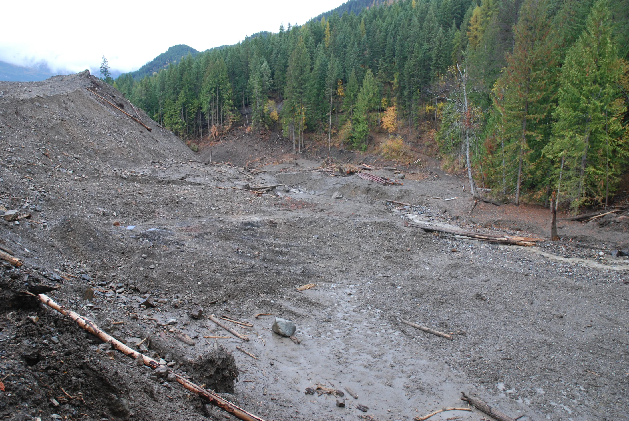
October 2012. The landslide created a long disturbed path through steep forested terrain.
Full dated photo record
These photographs use verified project originals and dated archive folders. Viewpoints vary across the sequence.
2012-10-16. The landslide created a long disturbed path through steep forested terrain.
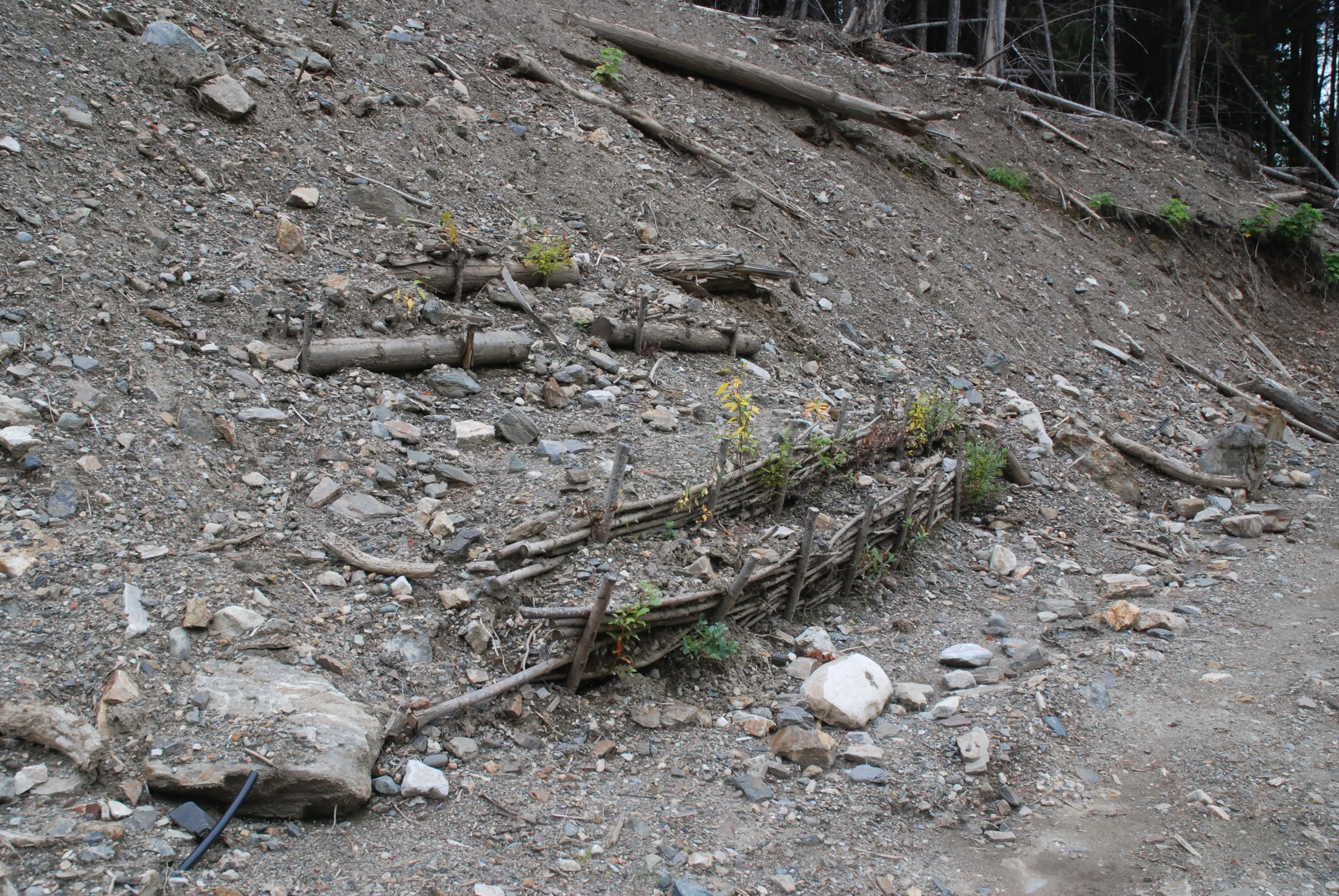
2014-09-12. Early woody cover was developing among naturally colonizing plants.
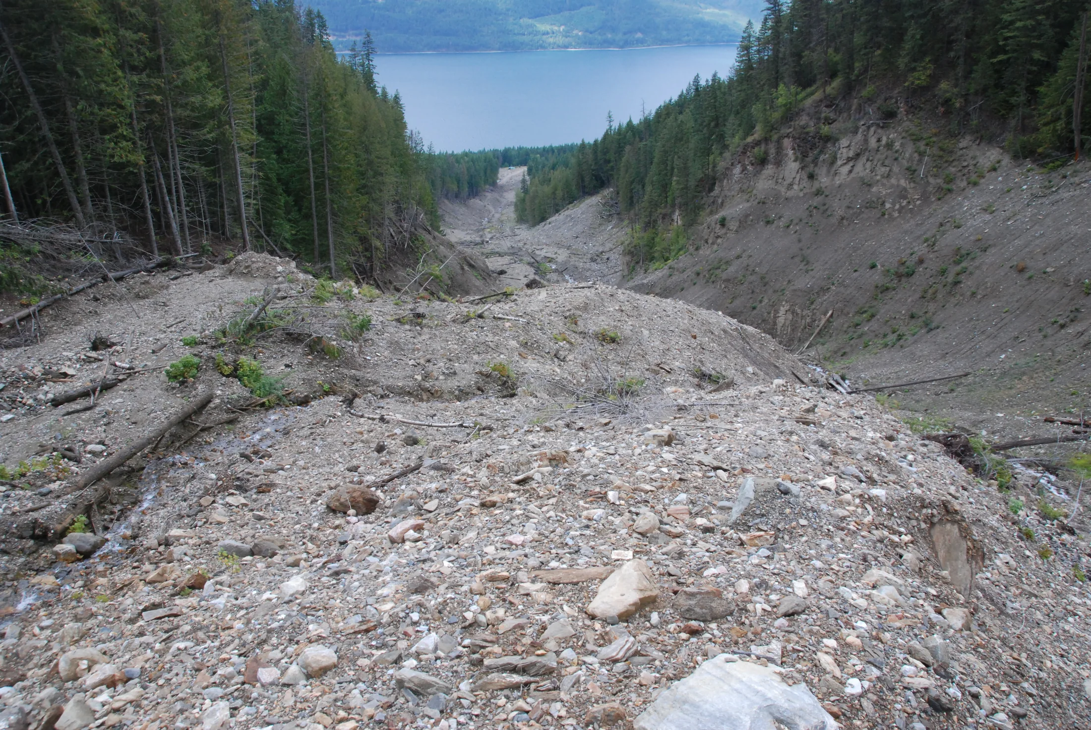
2015-09-04. Woody plants were expanding across the treated area.
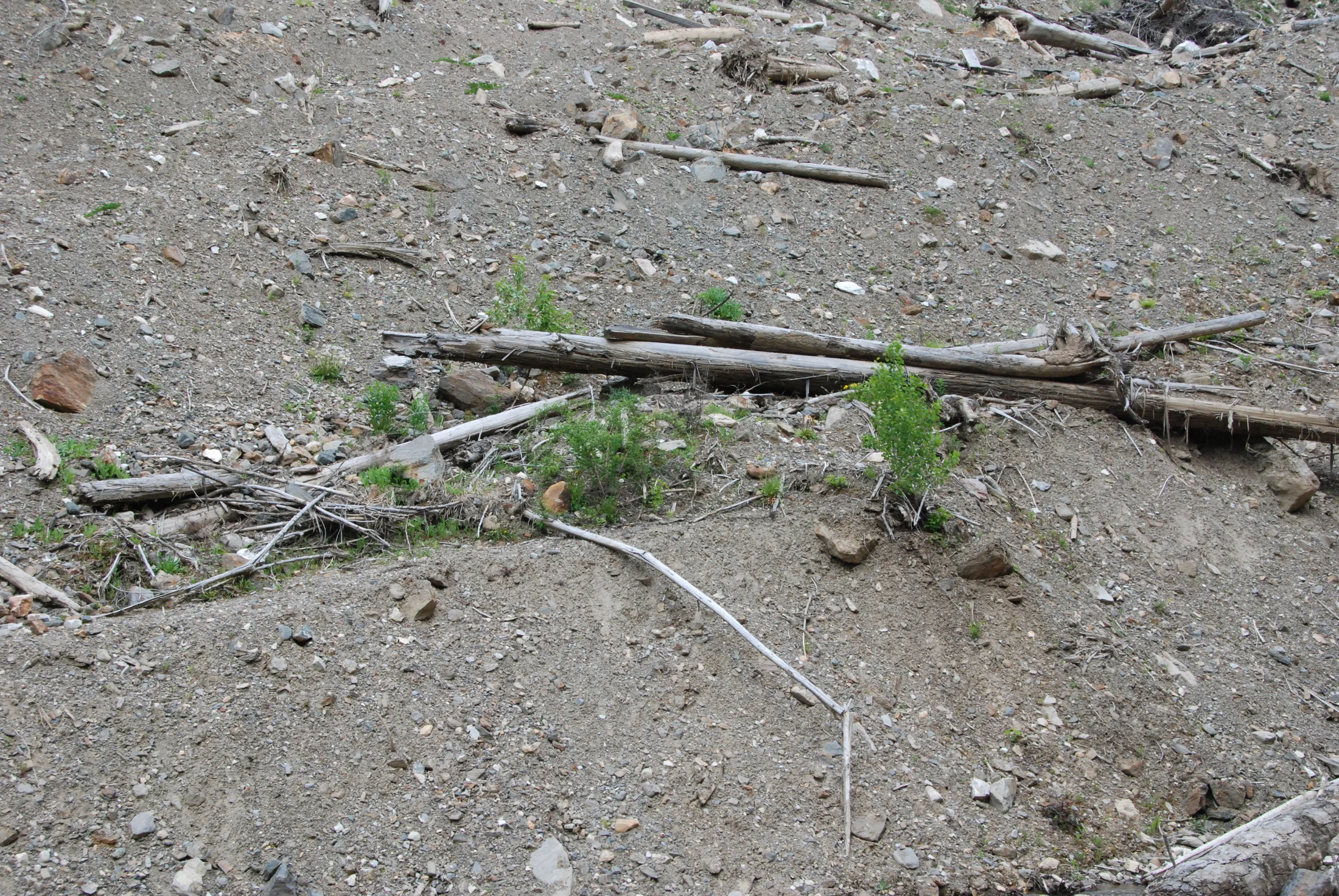
2016-05-04. Planted and naturally arriving species were forming a varied plant community.
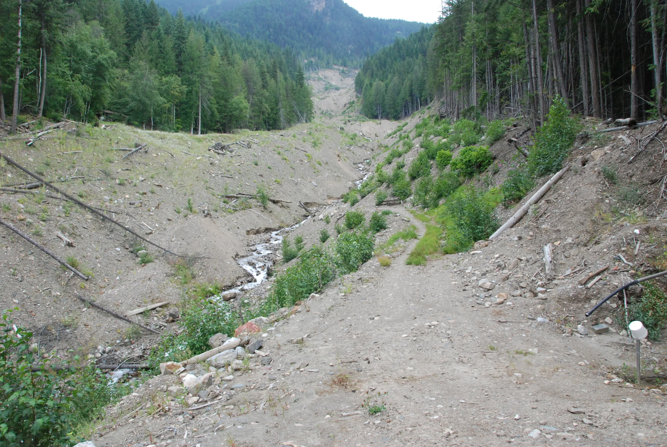
2017-07-22. Native woody growth continued to spread across the deposition zone.
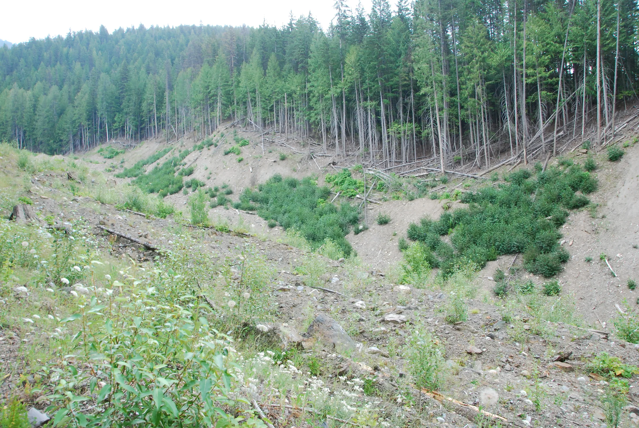
2018-07-27. Established shrubs and young trees show continued recovery in the accessible lower zone.
Observed ecological recovery
Later monitoring documented planted balsam poplar, alder, naturally arriving vegetation, and young conifers across portions of the treated area. Photographs from 2014 through 2018 show expanding woody cover in the accessible lower zone.
The work also demonstrates the social dimension of restoration. Teaching and working with community members supported practical recovery while keeping the loss associated with the landslide separate from any promotional message.
Planning restoration for a disturbed site?
PES develops site-specific restoration and soil bioengineering approaches grounded in field evidence.